TerraSolid- TerraStereo
Sophisticated Visualization of Very Large Point Clouds
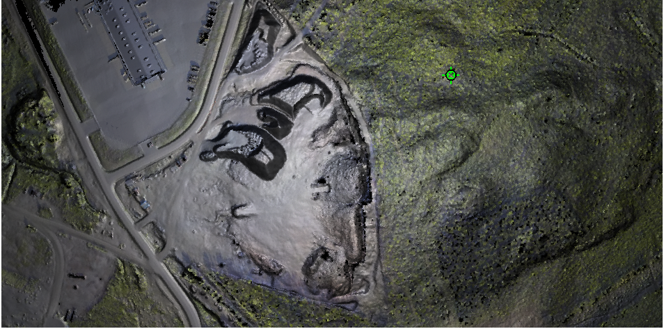
TerraStereo is a stand-along application for visualizing very large point clouds. It uses high-performance graphics boards
for rendering huge amounts of points fastly and in high quality. The software enables you to:
Terrasolid Ltd.
Kanavaranta 7 B 2800160 Helsinki
Finland
Phone: +358 400 648 391
E-Mail: [email protected]
Internet: www.terrasolid.com
Visualize up to 50 billion points that are organized in a TerraScan project
Perform visual analysis and quality check in both, small and large scale displays
Navigate through the point cloud freely or based on TerraScan trajectory files
Create animations
Combine different visualization channels in order to improve the perceptibility of objects in the point cloud
Switch point classes on/off
Apply elevation exaggeration to the point cloud for specific analysis tasks
Measure distances within the point cloud
View laser data in stereo mode and create stereo screencaptures
Easily change between different display channels and point rendering modes
Digitize line vector elements and export them to TerraSurvey
... and more!
- Easily change between different display channels and point rendering modes
- Elevation, intensity and class coloring
- Color by RGB values
- TerraZ rendering method for masking foreground objects
- Shaded surface display
- Point density coloring
- Shaded surface display
- Different quality levels for point rendering
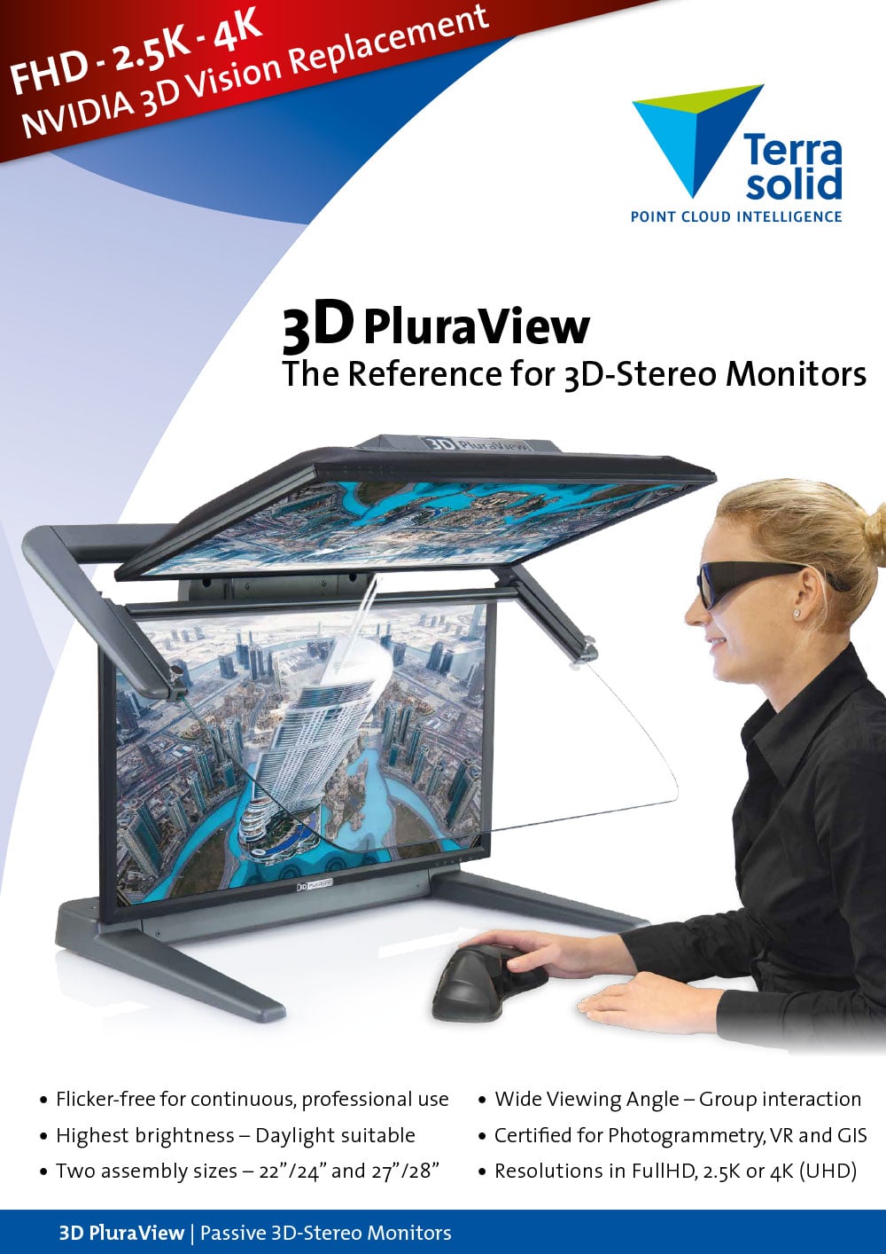
3D PluraView Monitor – Prospekt-Download