3D PluraView
in Geospatial Applications
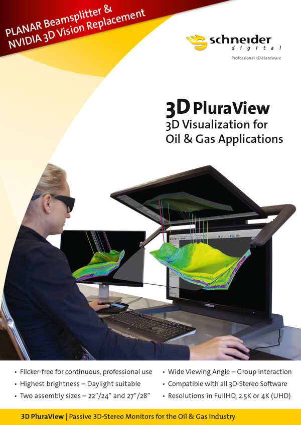
3D PluraView – stereoscopic 3D-visualisation for the oil- and gas industry
Optimum visualization for stereoscopic 3D geo-datasets at the workplace
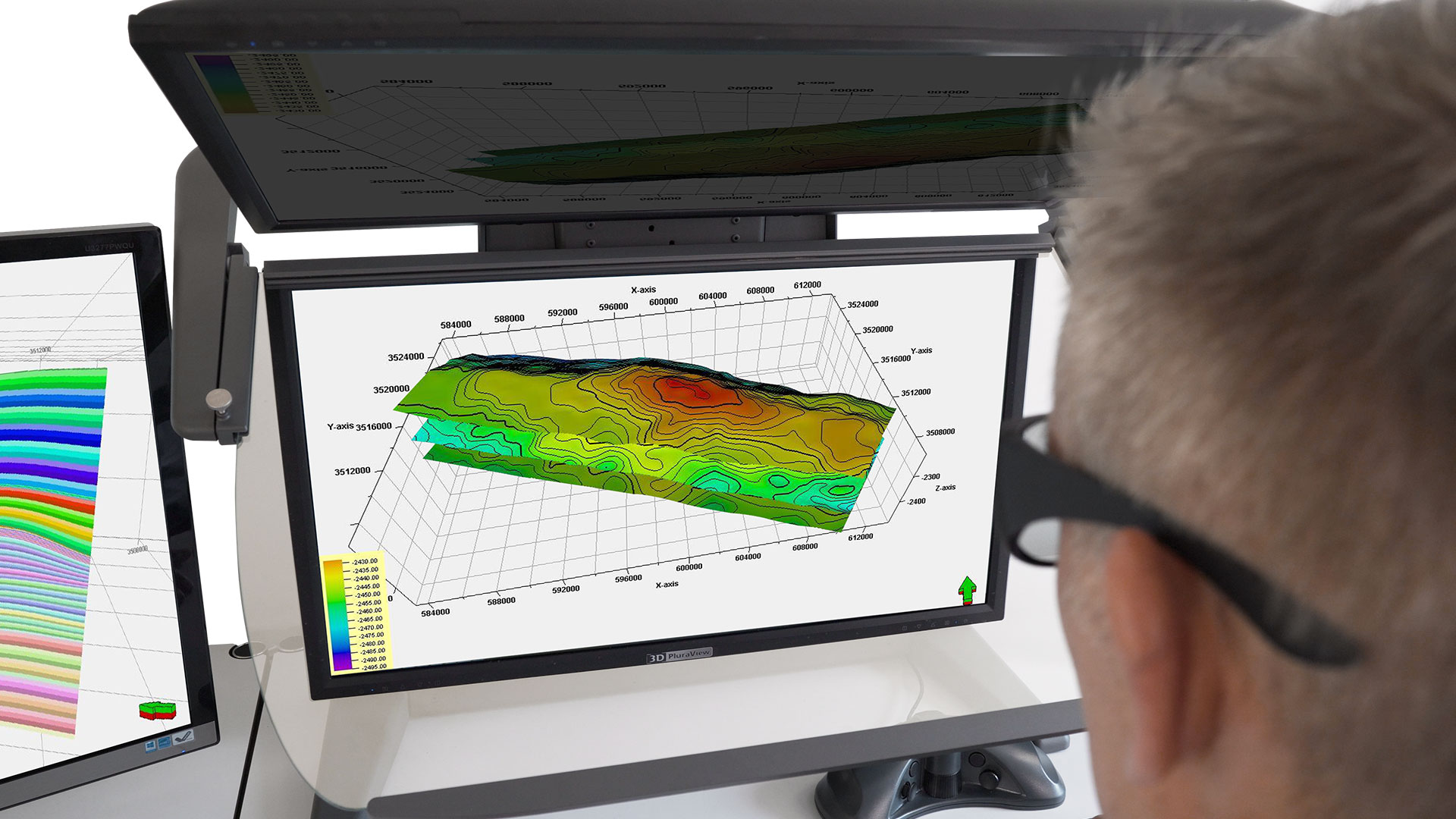
3D spatial data visualization for stratigraphic and tectonic surfaces
Interpretation of 3D seismic data
Integration of 3D surface and subsurface datasets
Assessment and analysis of reserves
Play development planning
3D modeling of property rights
Preparation and visualization of directional drilling pathways
Reservoir simulation, pressure drop modeling
Dynamic modeling of finite elements (FEM)
Oil & Gas 3D printing applications
Software training for geologists, geophysicists, petroleum engineers
Geo-scientific education
Industrial plant simulation / installation of production equipment
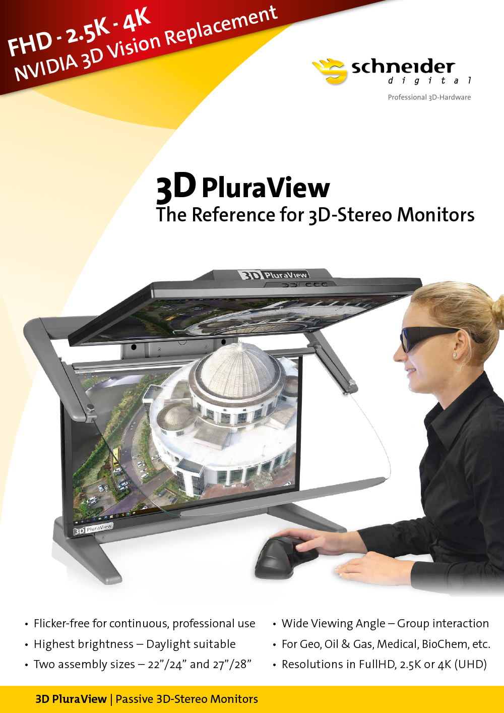
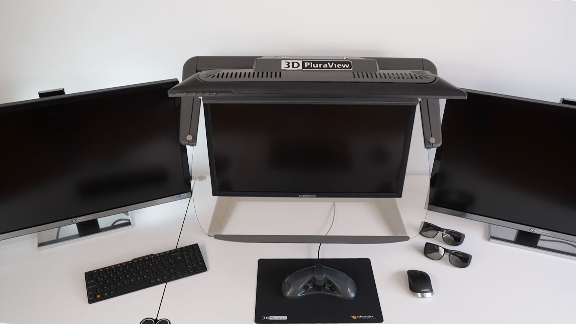
The 3D PluraView monitor family – Meeting the highest requirements for the oil- and gas industry
The reference for passive 3D stereo displays
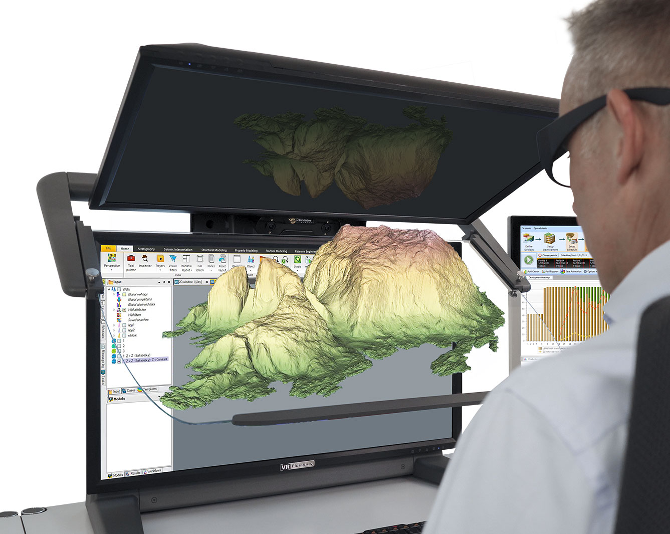
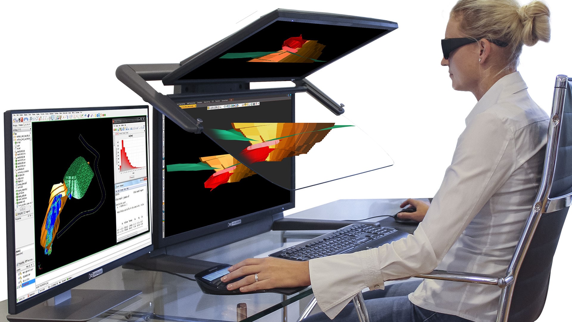
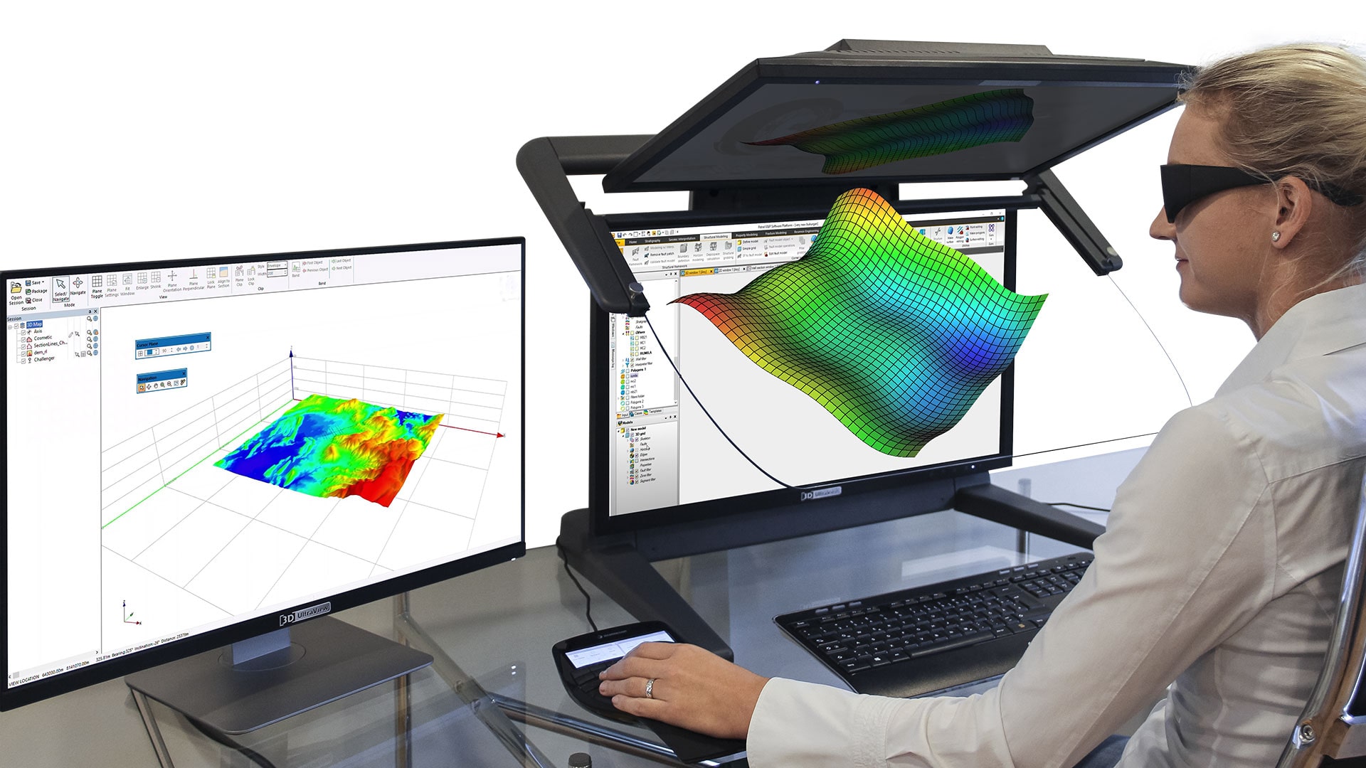
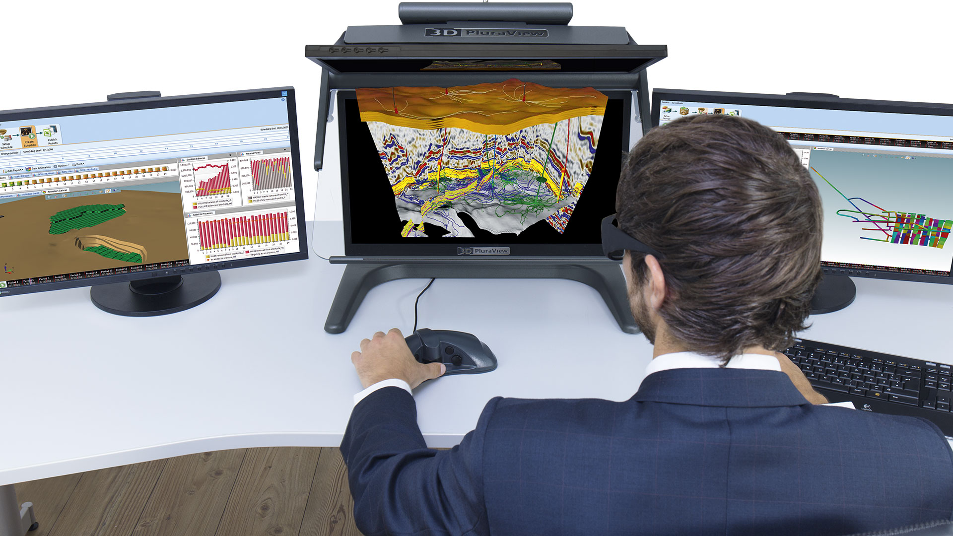
In order to optimize the exploration and production of oil and gas fields, assess potential and increase yield, it is mandatory to understand all aspects of the geological subsurface situation. A higher level of understanding will lead to an earlier recognition of problems, reduce avoidable delays and associated, substantial expenses. The optimal visualization of 3D geo-datasets is the key for geologists and geophysicists to analyze and evaluate geological and geophysical information components with the highest degree of confidence. The stereoscopic 3D PluraView dual-screen systems with integrated beam splitter mirror from Schneider Digital, offer such an optimal 3D visualization right at the workplace.
With up to 4K resolution per screen and stereo-channel, the user benefits from a readily available, extremely bright and high-contrast 3D-stereo display on his/her desktop, when evaluating stratigraphic profiles, seismic 3D data, borehole information and derived 3D models. In the oil and gas industry, stereo-capable software platforms, such as Petrel from Schlumberger, Halliburton GeoProbe or MapInfo Discover are utilized. These allow the professional user to integrate, display and analyze all relevant subsurface information components quickly and comprehensively, display variants and associated simulations, improve play understanding and ultimately support more accurate hydrocarbon recovery forecasts. The visualization in 3D-stereo is an integral part of a ‘best-practice toolkit’, ensuring the success of the project.
High resolution
FullHD, 2.5K or 4K per eye
Wide Viewing Angle
for comfortable work even in a team
Supported Graphics Cards
all NVIDIA Quadro & all AMD FirePRO / RadeonPRO
Flicker-Free
for professional continuous use
Software Certified
for all 3D stereo applications
Compact Design
Two different assemblies for optimal space utilization
Daylight suitable
with two bright and high-contrast displays
Functional design
Highest quality – Made in Germany
Plug & Play
Works without driver under Windows /LINUX / macOS
Optimum visualization for stereoscopic 3D geospatial at the workplace
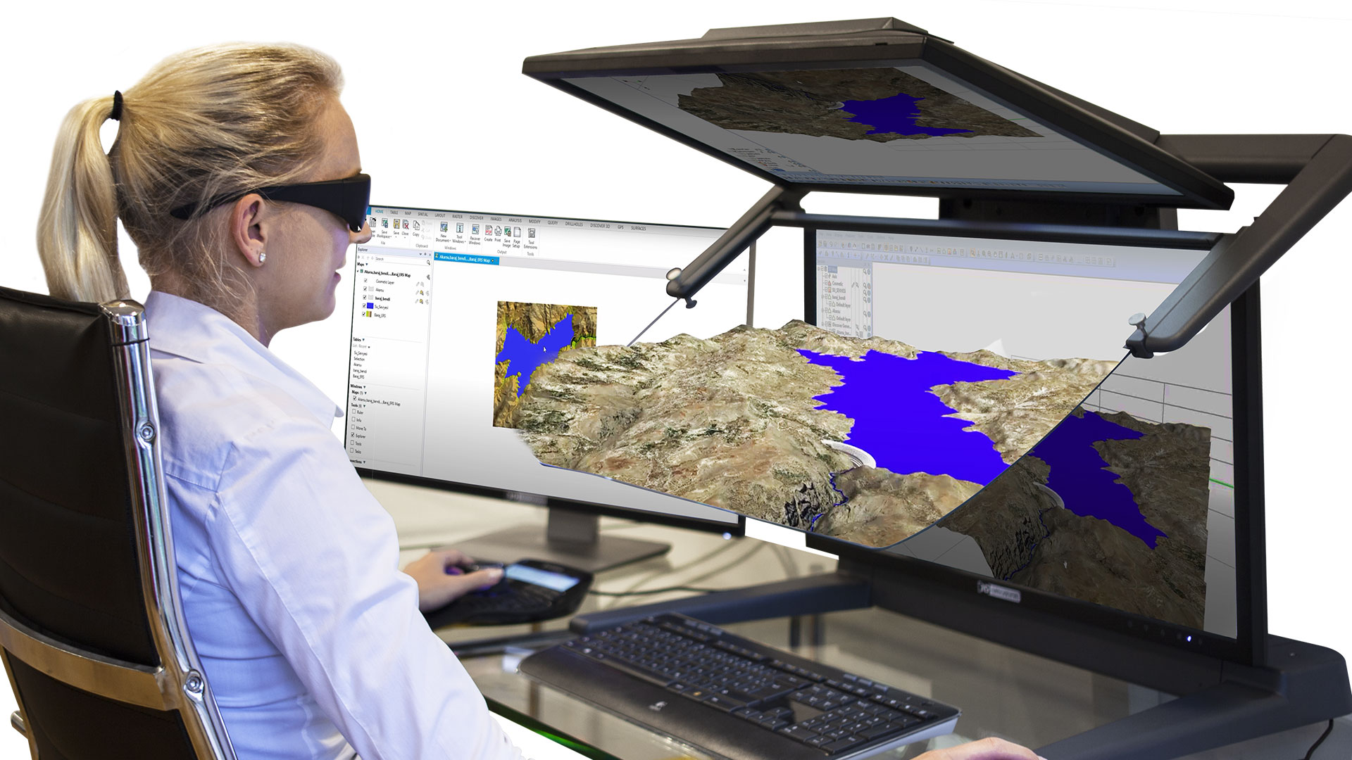
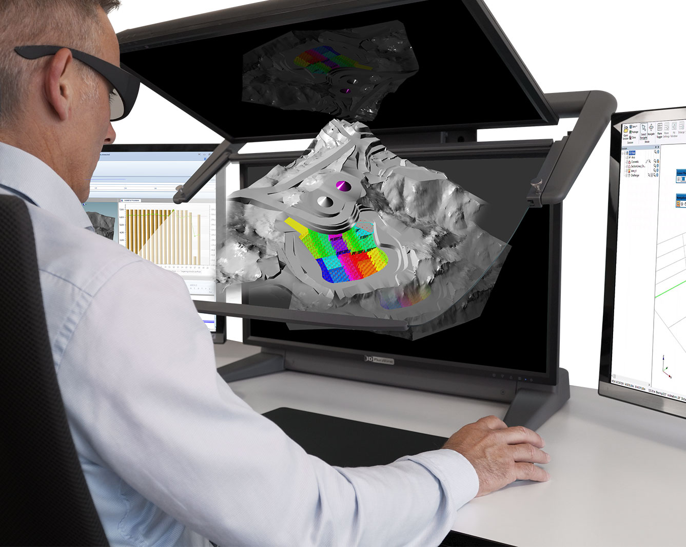
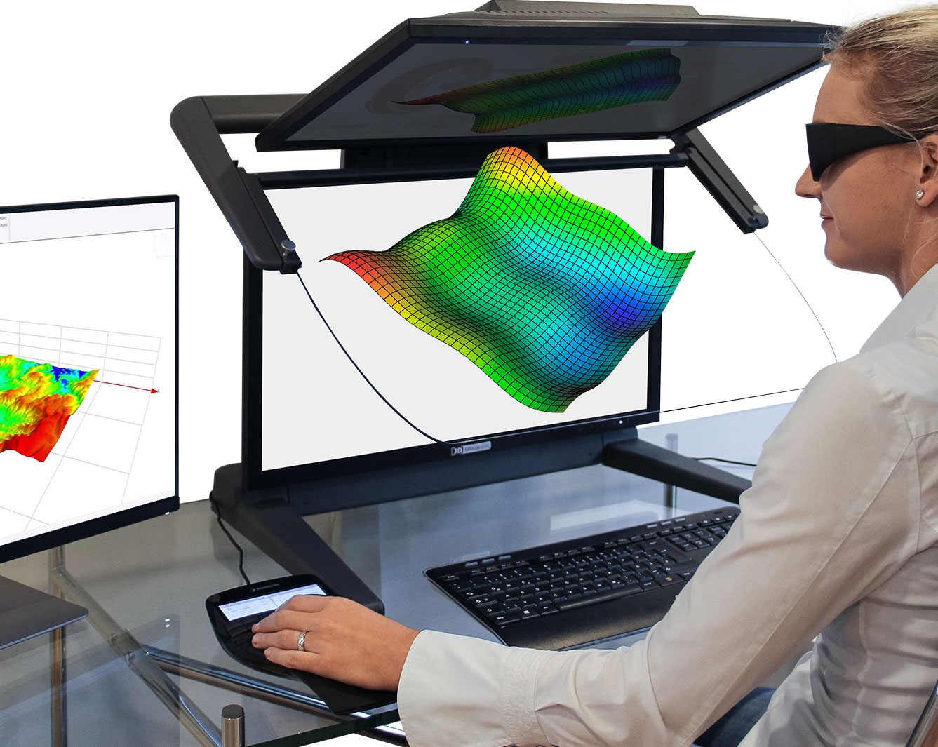
The 3D PluraView monitors are ideally suited to display 3D subsurface reservoir models stereoscopically in 3D, together with detailed surface datasets. With two high-resolution screens, the stereoscopic image pairs for the left and the right eye are combined by the so-called ‘beam splitter’, a specially coated, transflective mirror, to form a very bright and highcontrast holographic stereo image. Due to the different polarization angle of the PluraView glasses, both stereo channels are separated for the left and the right eye, resulting in a perfect 3D-stereo display for the professional desktop.
The stereoscopic visualization is an essential part for the industry’s geology software, such as Schlumberger Petrel, Halliburton GeoProbe, Baker Hughes JewelSuite, the Dassault GEOVIA Modules or MapInfo Discover. As the global market leader in the GIS sector, Esri has implemented with ArcGIS Pro a fully stereoscopic 3D GIS environment. ArcGIS Pro enables also the mapping of stratigraphic and tectonic subsurface structures with 3D voxel elements.
The visualization and especially the editing of spatial structures in a 3D-stereo environment is definitely a key function. With a stereoscopic display, real spatial relationships can be understood immediately and intuitively and can be captured with great precision, compared to regular screens which can only display a flat 2D-perspective view, without any depth information.
Modern software environments for exploration and production are always three-dimensional and volumetric. Due to the high costs and risks involved, they must be as efficient as possible, reliable and optimized in terms of data processing. The ensuing field activities must meet all HSE standards and therefore the entire process chain must verifiably and fully correspond to the current state of the art and ‘best practice’.
3D PluraView - Advantages & Benefits
3D PluraView monitors are fully compatible with almost any workstation, even laptop hardware. Most professional software applications require only a standard professional graphics card for visualization.
No need for special drivers or IT configurations, no stereo signal emitters, as required by active shutter glasses. 3D PluraView monitors work with standard NVIDIA or AMD graphics drivers and are futureproof, operating with the latest Windows or Linux versions.
Absolutely flicker-free and therefore permanent, comfortable usage thanks to very light, passive and cross-polarized stereo glasses.
Shared stereoscopic viewing for small workgroups of two to six users, especially with the 27“ and 28“ 3D PluraView models.
Fully integrated and usable in normal office daylight environments due to bright and high-contrast displays with up to 4K resolution per stereo channel.
True spatial depth perception in 3D-stereo display mode, promoting an intuitive and faster understanding of stratigraphic and tectonic features and relationships.
Best 3D-stereo visualization solution for geospatial professionals and engineers, supporting all stereoscopic features of leading software applications.
Substantial decision support through 3D visualization, better validation of work results as well as error avoidance and less scope for misinterpretations.
3D PluraView compatible gas & oil software applications
3D PluraView monitors are predominantly used in graphics-intense Geospatial applications such as 3D spatial data visualization for stratigraphic and tectonic surfaces, Interpretation of 3D seismic data, Integration of 3D surface and subsurface datasets, Assessment and analysis of reserves, Play development planning, 3D modeling of property rights, Preparation and visualization of directional drilling pathways, Reservoir simulation, pressure drop modeling, Dynamic modeling of finite elements (FEM), Oil & Gas 3D printing applications, Software training for geologists, geophysicists, petroleum engineers, Geo-scientific education, Industrial plant simulation / installation of production equipment, etc.
With currently over 2,000 monitor systems installed and more than 200 compatible 3D-Stereo software applications available, the 3D PluraView is the market leader and established reference for 3D visualization in professional gas & oil application areas:


Contact us: [email protected]
Geospatial


3D PluraView – oil- and gas industry application examples, use cases & references


Reliably authorize exploration results through 3D models
Professional 3D stereo visualization for GEOINT and immersive, virtual simulation environments
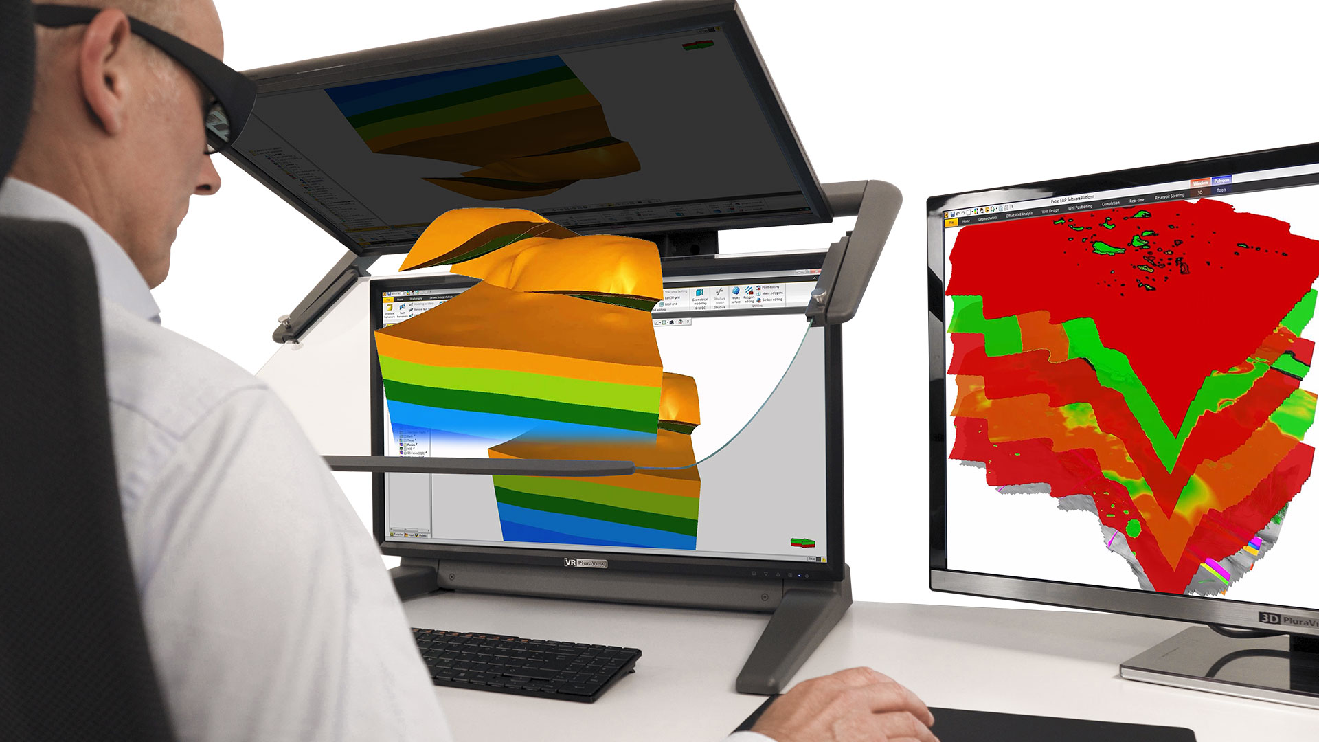
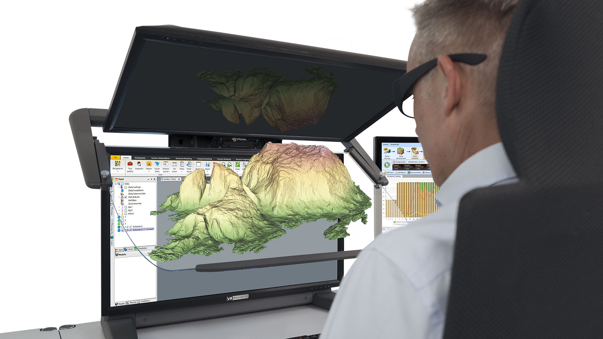
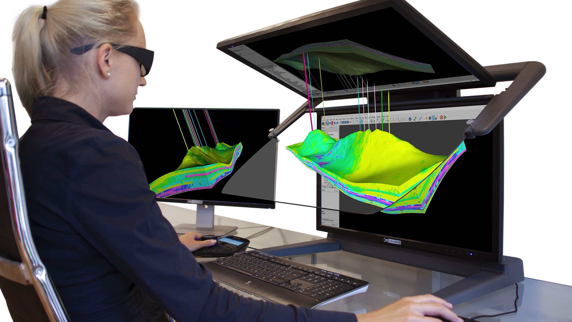
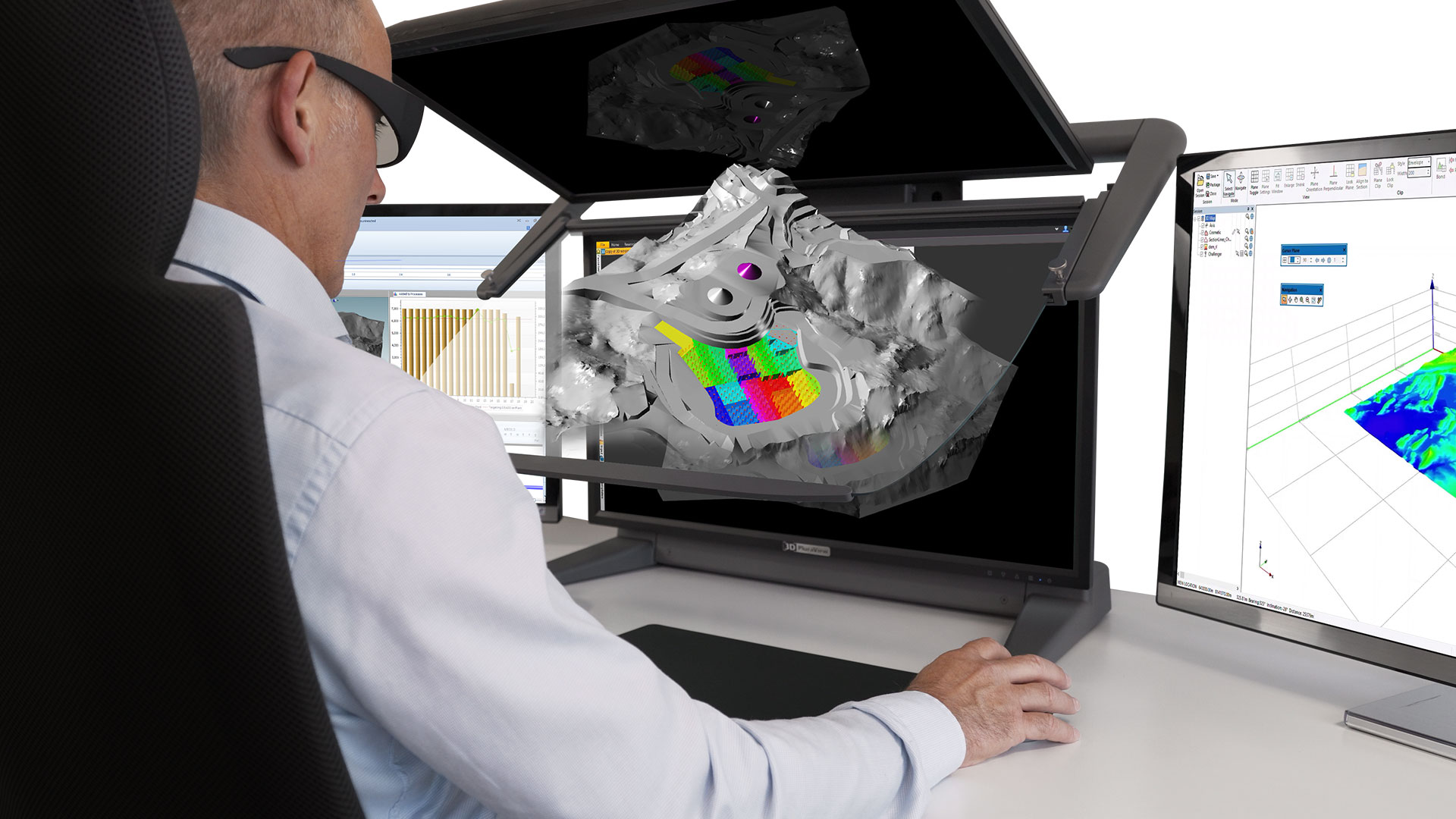
A comprehensive and accurate understanding of the available 3D geological and geophysical data is required to comprehend the stratigraphic and tectonic structures, as well as the rock properties of oil and gas reservoirs in relation to their production potential. Among other things, seismic 3D profiles are recorded for this assessment, to identify reflective horizons, structures and faults. Together with results from other data sources, such as existing well logs, aeromagnetics and electrical resistivity tomography, all information is merged to create the most competent 3D reservoir model possible. If the evaluation is positive, this preliminary model will then be expanded by additional geo-datasets to support justifiable decisions about the future number, positioning, direction and depth of additional exploration boreholes, or the drilling of the first production wells.
The representation of the reservoirs in “real” 3D is also ideal for creating comprehensive static and especially dynamic models in 4D time-lapse series for clearly simulating pressure drop and flow changes under various production scenarios. The best-possible combination, evaluation and interpretation of various 3D features is essential for the closest digital representation of the reservoir. This includes all major tectonic structures such as sealing or non-sealing faults and the modeling of stratigraphic layers. In particular, it includes as much information as possible about the source-, reservoir- and cap rock layers. Highly relevant are the accurate depth and structure of reflection horizons from geophysical exploration, combined with all physically present rock material from drill cuttings and core samples within the investigation area, as well as the determination of further petrophysical rock parameters by geophysical downhole probes. A “good” subsurface model shows the spatial relationships and properties of relevant features in sufficient detail and can therefore be used with acceptable accuracy to estimate the future behavior of an oil and gas reservoir under different production scenarios.
With the stereoscopic visualization technology from Schneider Digital, it is possible to perfectly visualize the correct spatial relationships of reservoir structures and their properties.
Get results faster and more reliably with 3D stereo
This allows oil and gas engineers to evaluate potential reservoirs, estimate reserves, and predict reservoir properties and production behavior. It enables them to further optimize production setup, complete projects on time and on budget, and ultimately increase the company’s competitiveness and profitability.
Especially at the transition point from exploration to production activities and associated surface installations, not only economic aspects are relevant, but strict environmental protection measures also have to be taken into account. Meeting associated requirements for official approval procedures are critical project milestone issues. Geospatial datasets that have been prepared on the desktop on 3D PluraView systems can be visualized just the same on large-format, stereoscopic projection systems and LED walls for larger groups of viewers, for instance for the company decision makers and public officials and thus presented in a much more easily understandable way.
The 3D PluraView monitors are the key element for geologists, geophysicists and engineers to create, visualize, analyze and understand complex 3D subsurface datasets, increasing confidence and leading to better-informed management processes throughout the project.
Complete oil & gas workspace solutions
Expand your 3D PluraView with powerful workstation hardware!
Schneider Digital is your partner for complete workplace solutions in the field of geospatial applications. Our product portfolio includes all components, from performance workstations specifically tailored to your requirements, 3D input devices (Stealth, Softmouse, 3DConnexion), side monitors up to 8K resolution, as well as professional graphics cards from NVIDIA and AMD.