3D PluraView
in Geospatial Applications
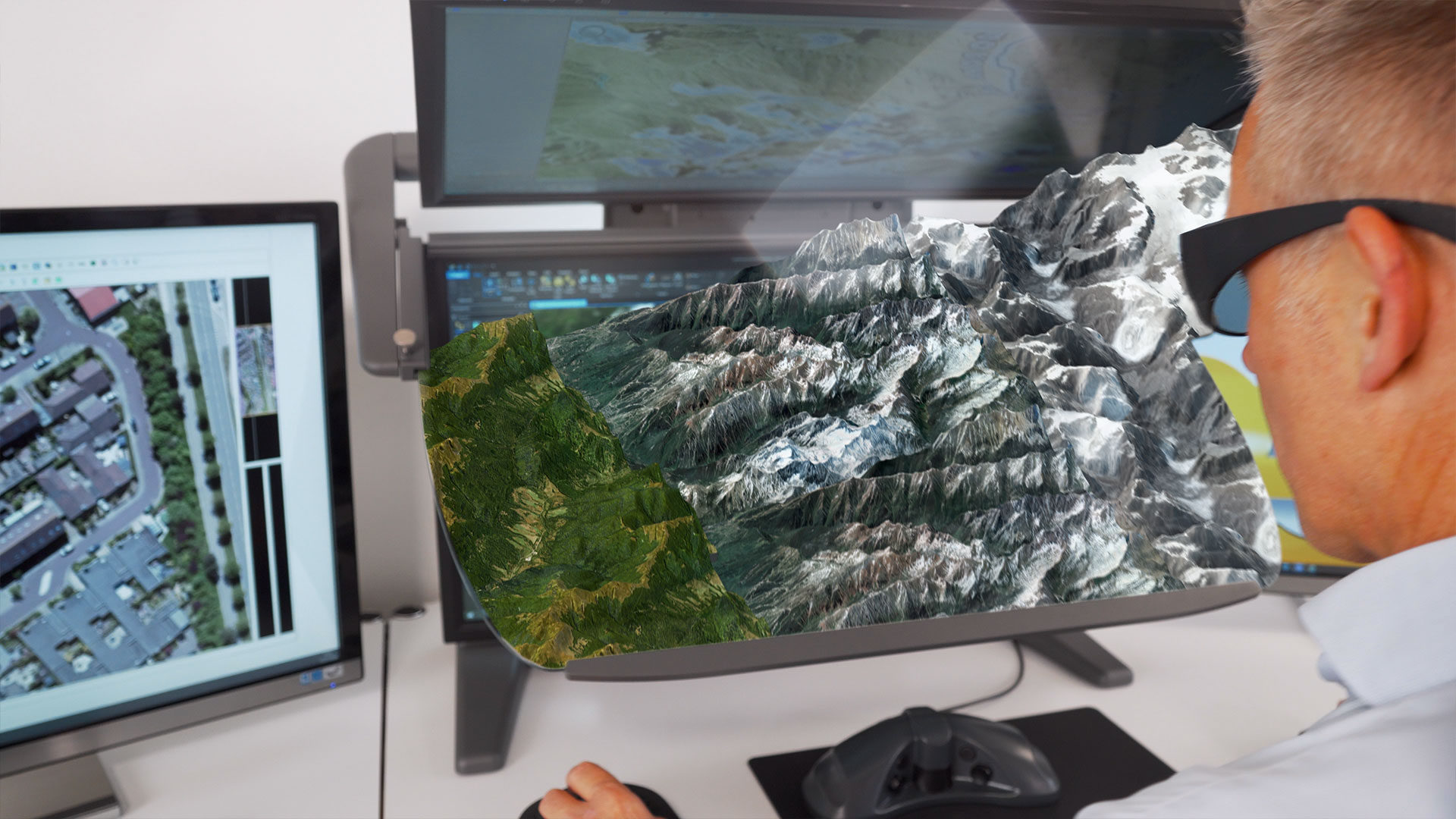
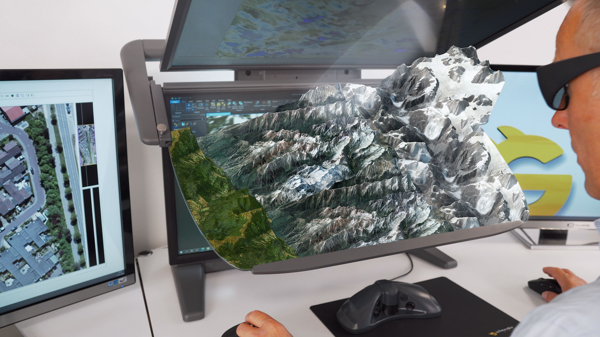
3D PluraView - Perfect 3D stereo monitor for innovative Geospatial applications
Unique high-end 3D Desktop Display for GIS, Photogrammetry and 3D City Modeling
GlS & 3D-Mapping
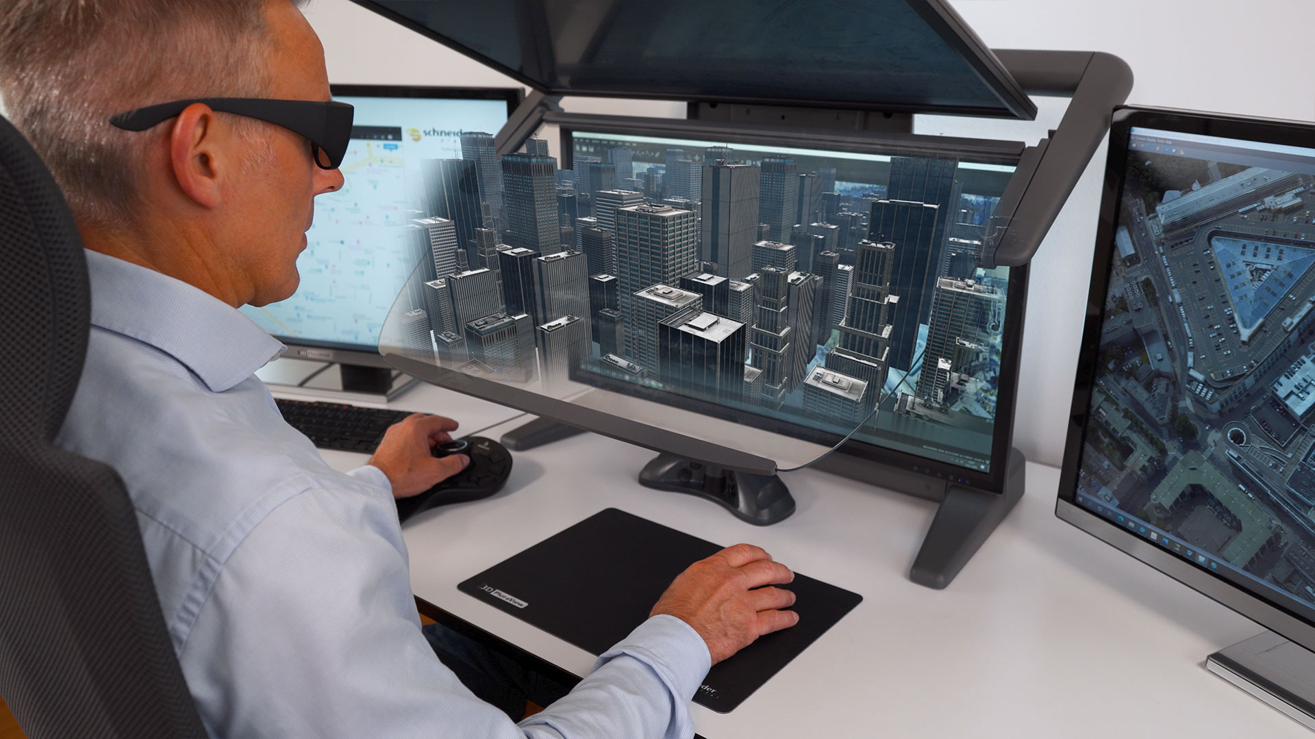
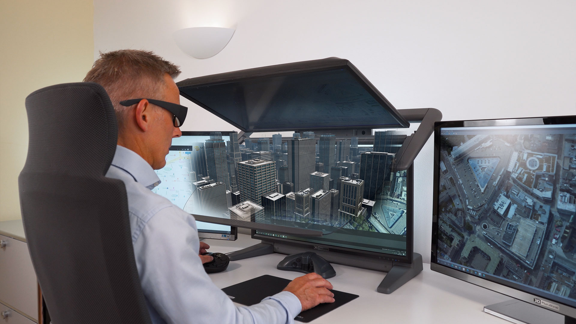
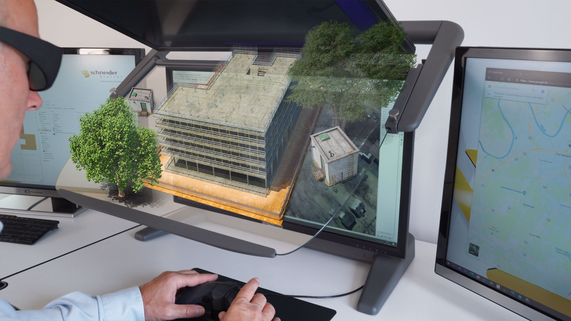
3D Urban Planning & City model visualization
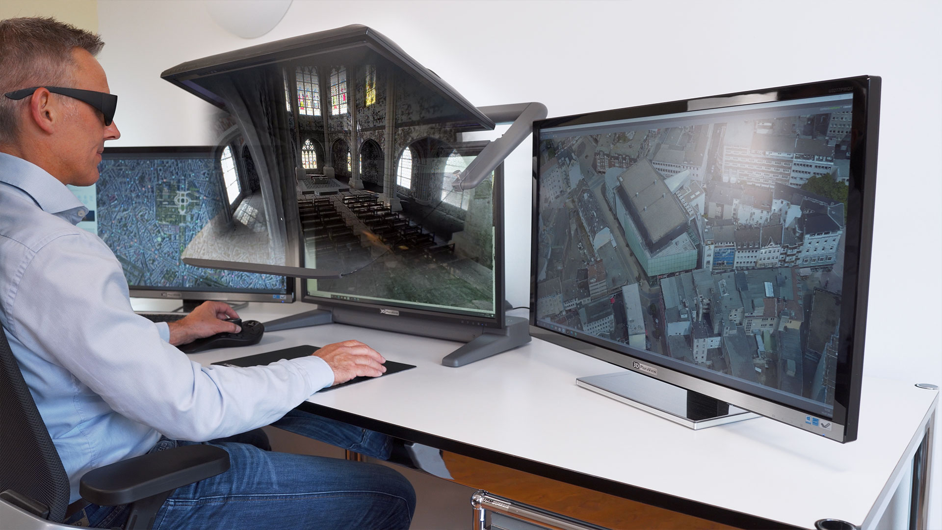
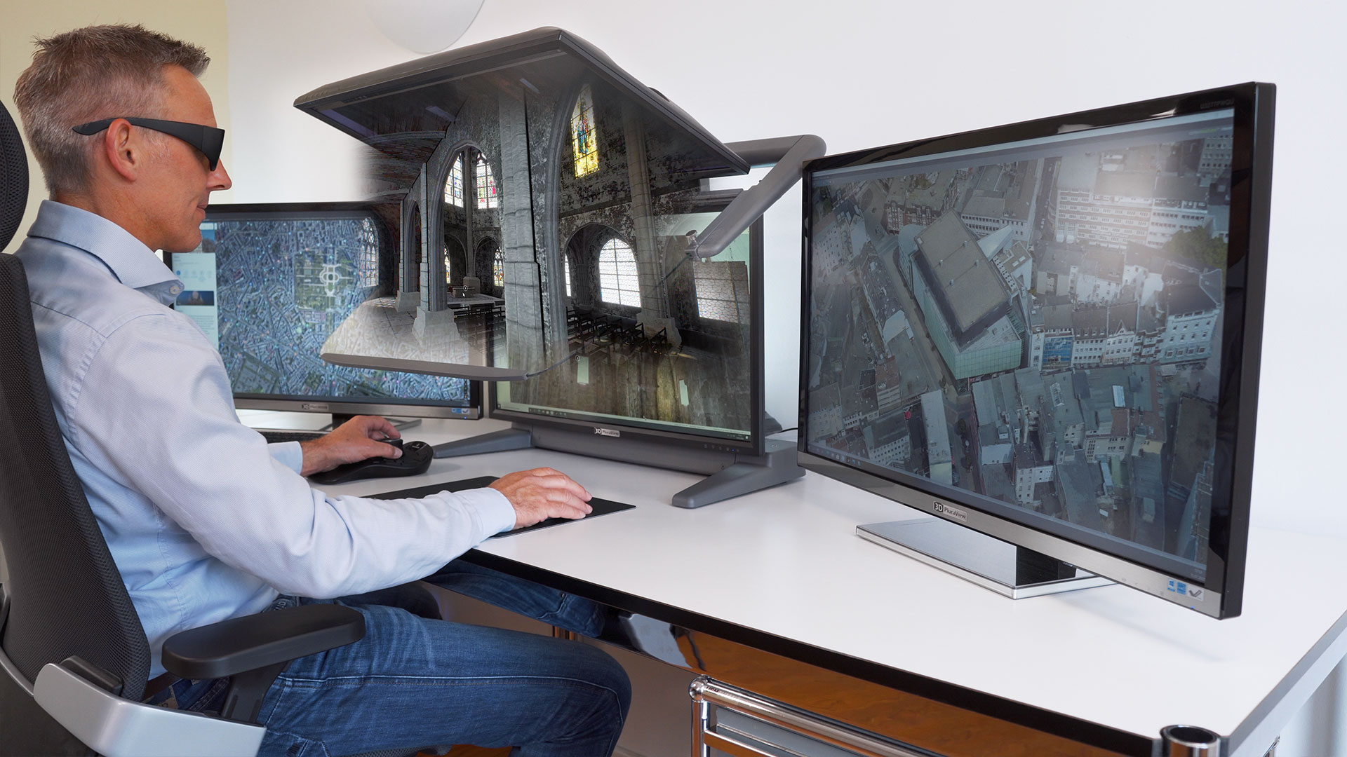
Photogrammetry & LiDAR data capture
Ordnance clearance & operation planning
Remote sensing & 3D satellite image analysis
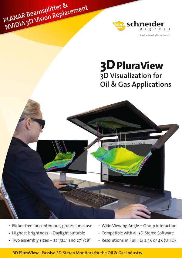
Oil & Gas prospecting & reservoir simulation
BIM (Building Information Modeling)
Archeology & Excavation research
The 3D PluraView monitor family – Meeting the highest requirements for Geospatial applications
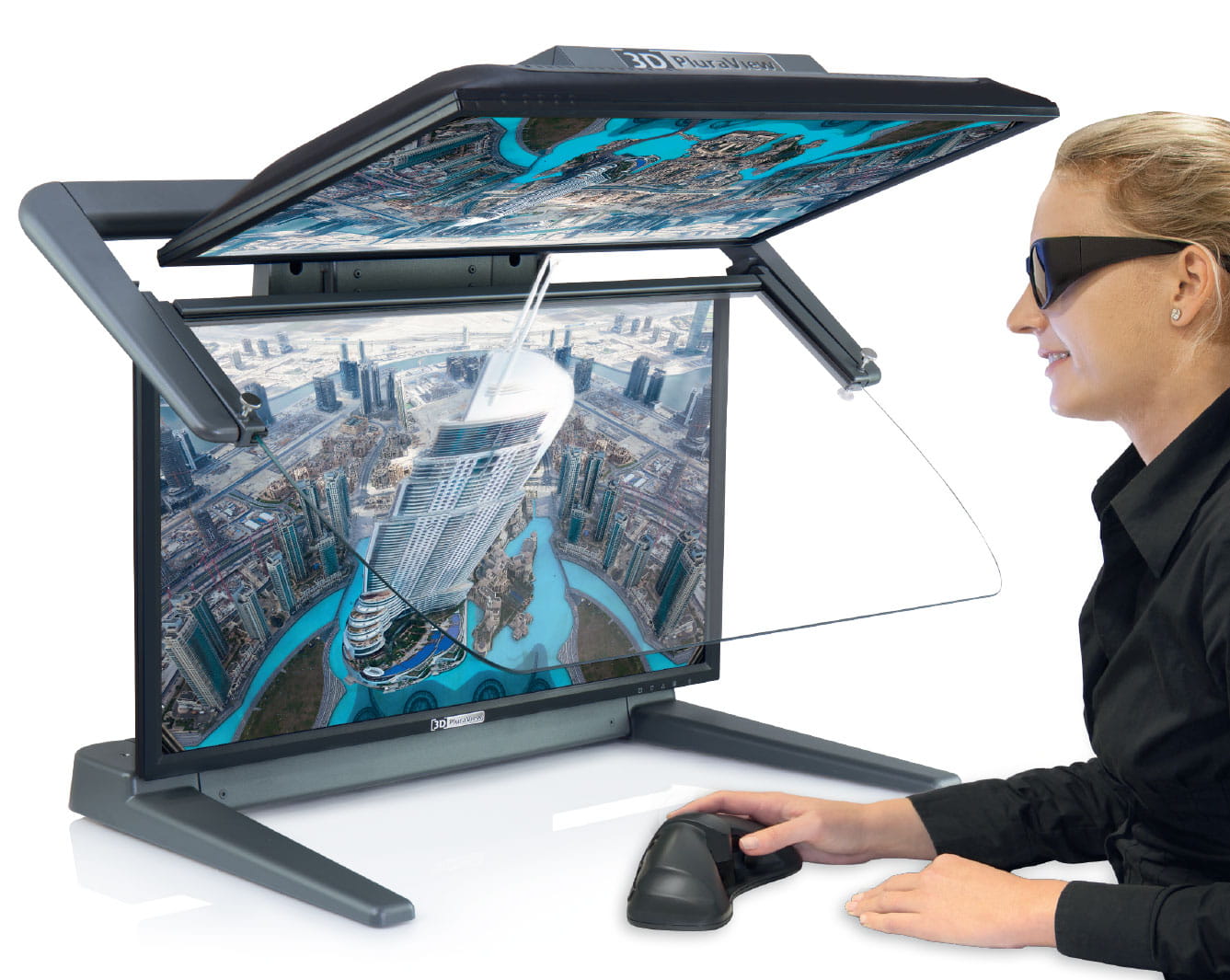
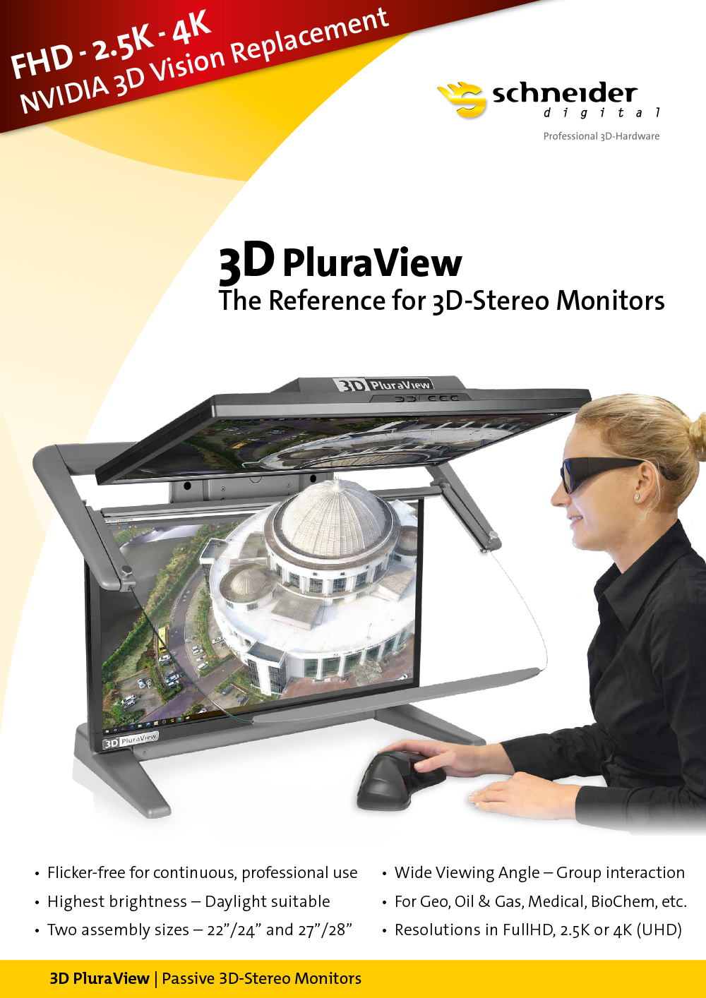
The reference for passive 3D stereo displays
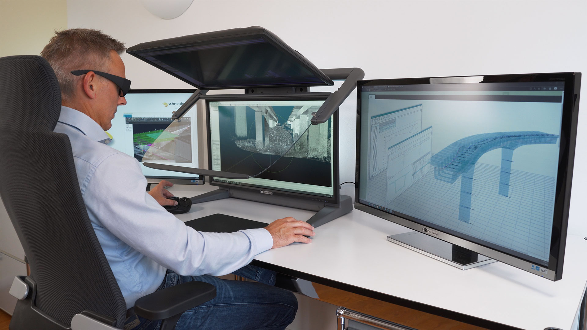
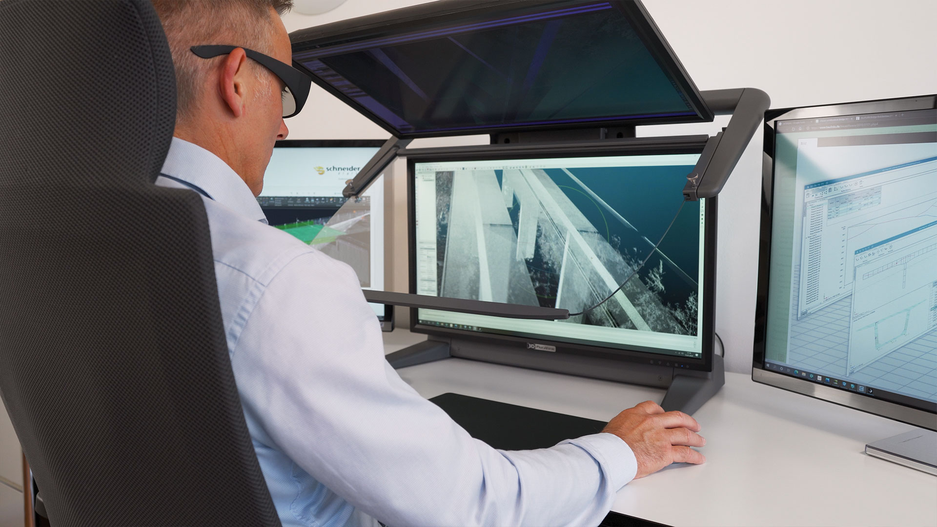
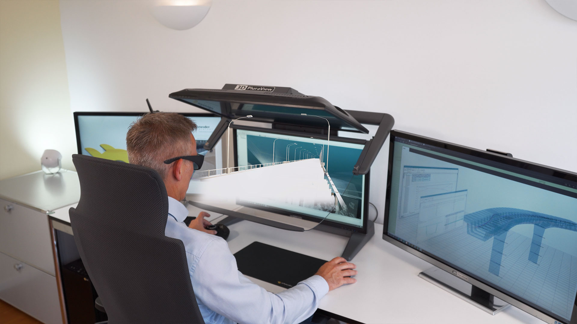
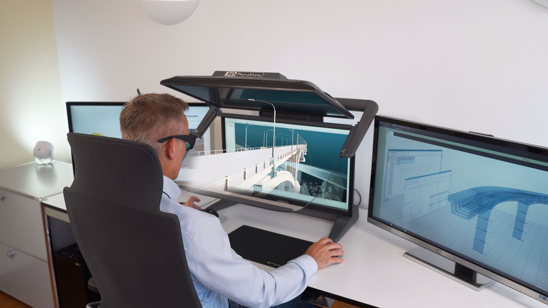
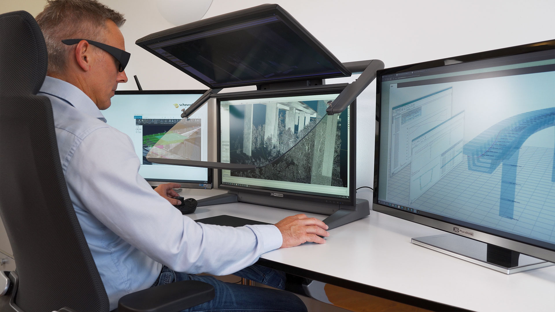
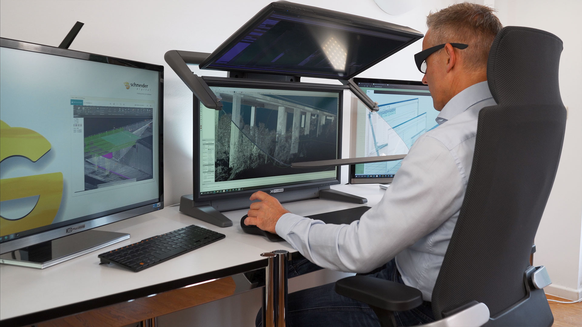
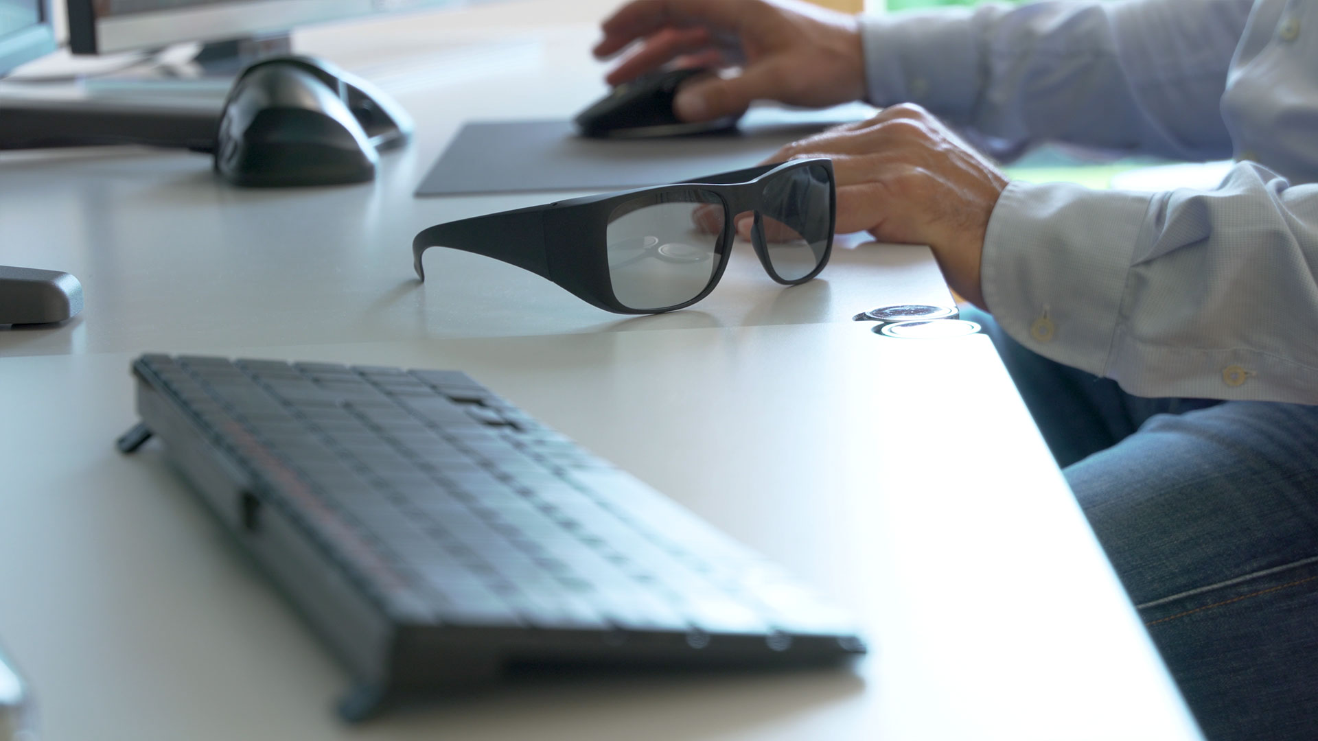
Anyone who depends on optimal 3D-stereo visualization, dealing with professional geospatial software, needs an absolutely flicker-free and daylight-compatible stereo monitor on the desktop. The 3D PluraView monitor series is the professional solution from Schneider Digital that enables fatigue-free, stereoscopic work throughout the day.The passively polarized 3D PluraView monitors are the 3D-stereo monitor system with the highest user acceptance and user satisfaction of all 3D displays currently available on the market!
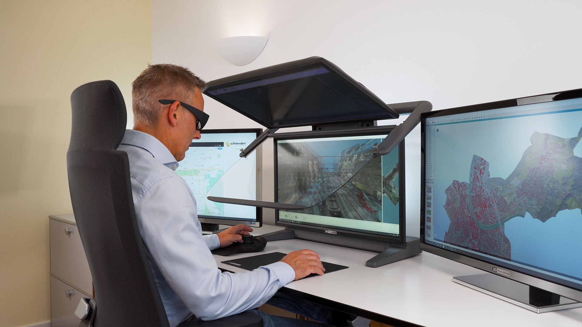
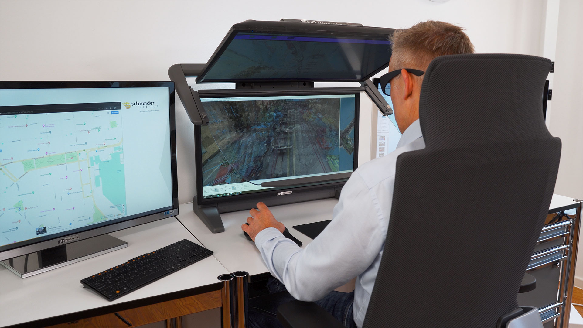
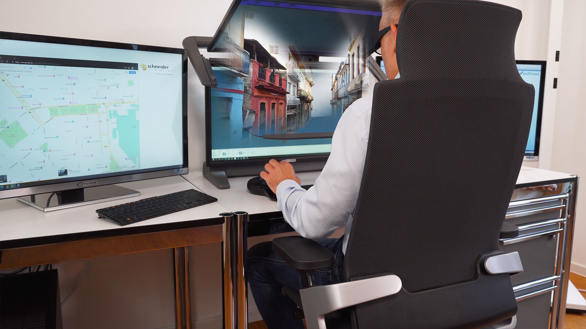
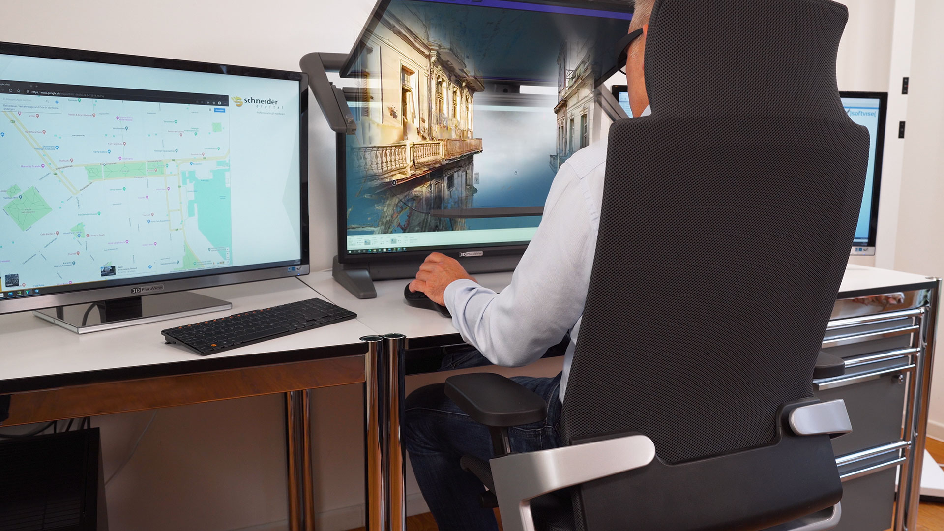
The 3D PluraView Stereo Monitor is the optimal solution for real 3D-stereo visualization in a wide variety of GEO / GIS areas, such as Photogrammetry, GIS & Mapping, LiDAR, 3D Scanning, for the oil & gas industry, BIM & 3D city modeling. Together with professional graphic cards, the PluraView is compatible as a plug & play system - without special graphics drivers - with stereo software applications from leading manufacturers - e.g. esri, Trimble-INPHO, Hexagon, Agisoft, DAT/EM, Terrasolid etc.
High resolution
FullHD, 2.5K or 4K per eye
Wide Viewing Angle
for comfortable work even in a team
Supported Graphics Cards
all NVIDIA Quadro & all AMD FirePRO / RadeonPRO
Flicker-Free
for professional continuous use
Software Certified
for all 3D stereo applications
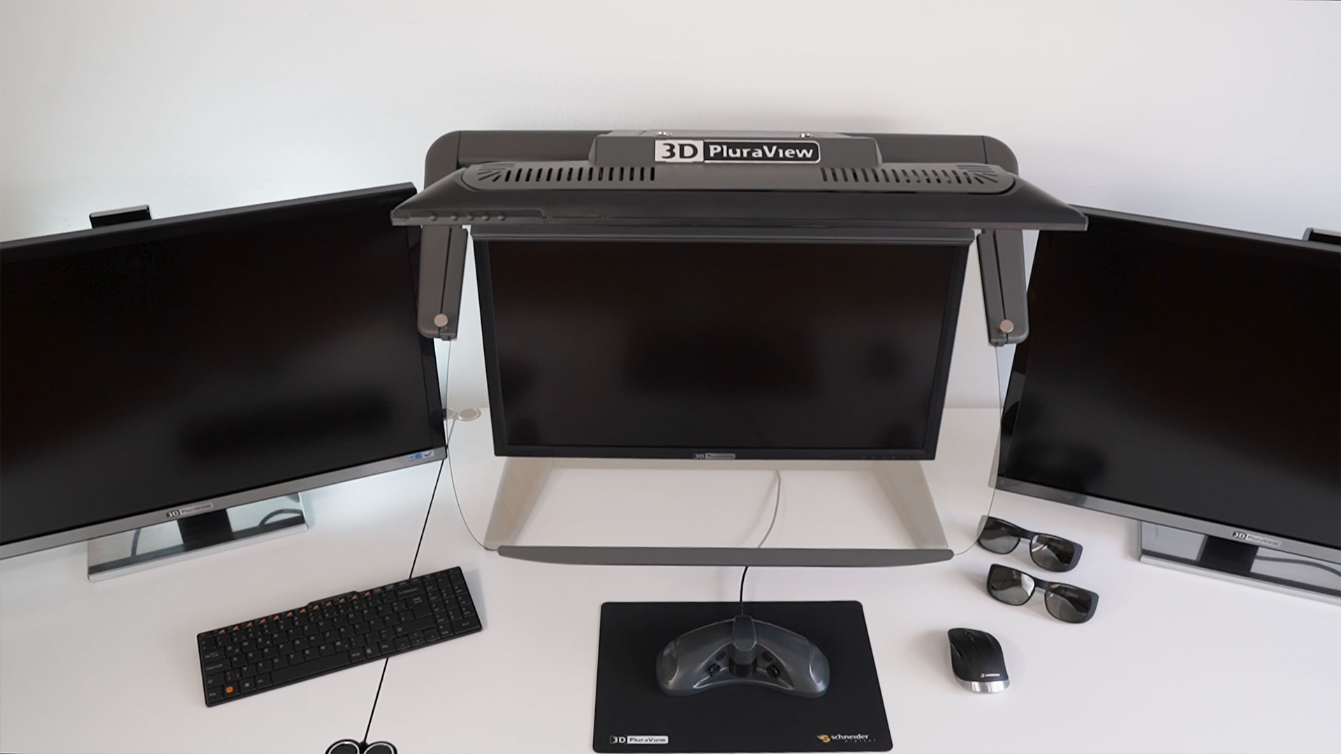
Compact Design
Two different assemblies for optimal space utilization
Daylight suitable
with two bright and high-contrast displays
Functional design
Highest quality – Made in Germany
Plug & Play
Works without driver under Windows /LINUX / macOS
Established technology, perfected for professional work in 3D stereo
The 3D PluraView monitors are the successors to the PLANAR 'beam-splitter' monitor series manufactured by PLANAR until 2015. This stereo technology is based on two monitors, a semi-transparent mirror and the combination with extremely light, passively polarized stereo glasses. Since the introduction of the PLANAR monitors over 15 years ago, this principle has proven itself to be the qualitatively best 3D-stereo display for desktop workplaces.
With a 28-inch screen diagonal, 4K (UHD) resolution and up to 10-bit color depth (with AMD Radeon PRO graphics cards), the 28 “PluraView from Schneider-Digital is the current 3D-stereo reference for all geospatial IT applications.
As a technologically superior alternative to active LCD shutter glasses, which are no longer available from the previous main supplier NVIDIA, the 3D PluraView monitor will continue to function 'Plug & Play' with every 'NVIDIA 3D Vision Pro'-compatible software application. This is also the case for the current Windows 10 version (Build 2004), which no longer supports NVIDIA 3D Vision LCD shutter glasses for desktop monitors.
The new 3D PluraView monitor with its innovative beam-splitter technology offers the highest quality available for desktop stereoscopic displays.The 3D PluraView is therefore ideally suited for all major stereo-capable applications in the geospatial industy, for GIS, Photogrammetry, LiDAR and especially for 3D City Modeling and the creation of realistic, digital 3D 'twins'.Highlights
3D PluraView - Advantages & Benefits
Passive Stereo Monitors have the highest user acceptance of any 3D display technology available.
3D PluraView users can work in normal daylight office conditions.
The flicker-free, bright 3D-stereo display substantially increases user motivation and productivity.
More than 10 years of experience in professional data production operations prove quality and perfect usability.
The new 3D PluraView models with full 4K stereo resolution enable new applications in BIM, medical applications or Laser scanning.
NEW! VR PluraView with Head & Object Tracking now available!
3D PluraView compatible Geospatial software applications
3D PluraView monitors are predominantly used in graphics-intense Geospatial applications such as 3D City Modeling, GIS, BIM, Photogrammetry & Remote Sensing, LiDAR 3D-point cloud editing, oil and gas exploration and plays, geology, hydrology and hydraulic engineering, meteorology and weather modeling, geodata processing, data analytics and reporting, geo-CAD applications, geo-planning, land survey, cartography & data visualization, navigation & telematics, etc.
With currently over 2,000 monitor systems installed and more than 200 compatible 3D-Stereo software applications available, the 3D PluraView is the market leader and established reference for 3D visualization in professional Geospatial application areas:


Contact us: [email protected]
Geospatial


3D PluraView – Geospatial application examples, use cases & references

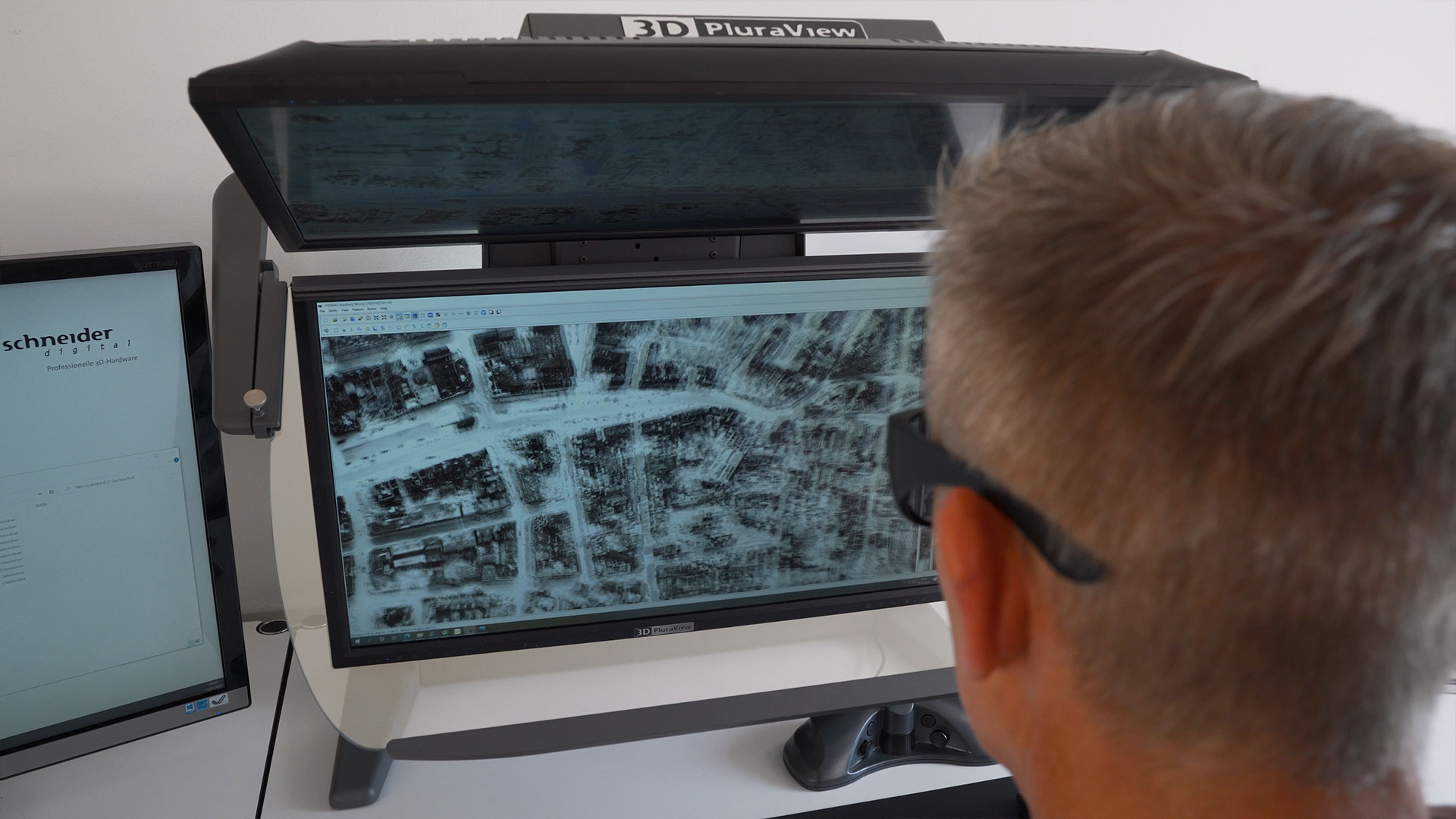

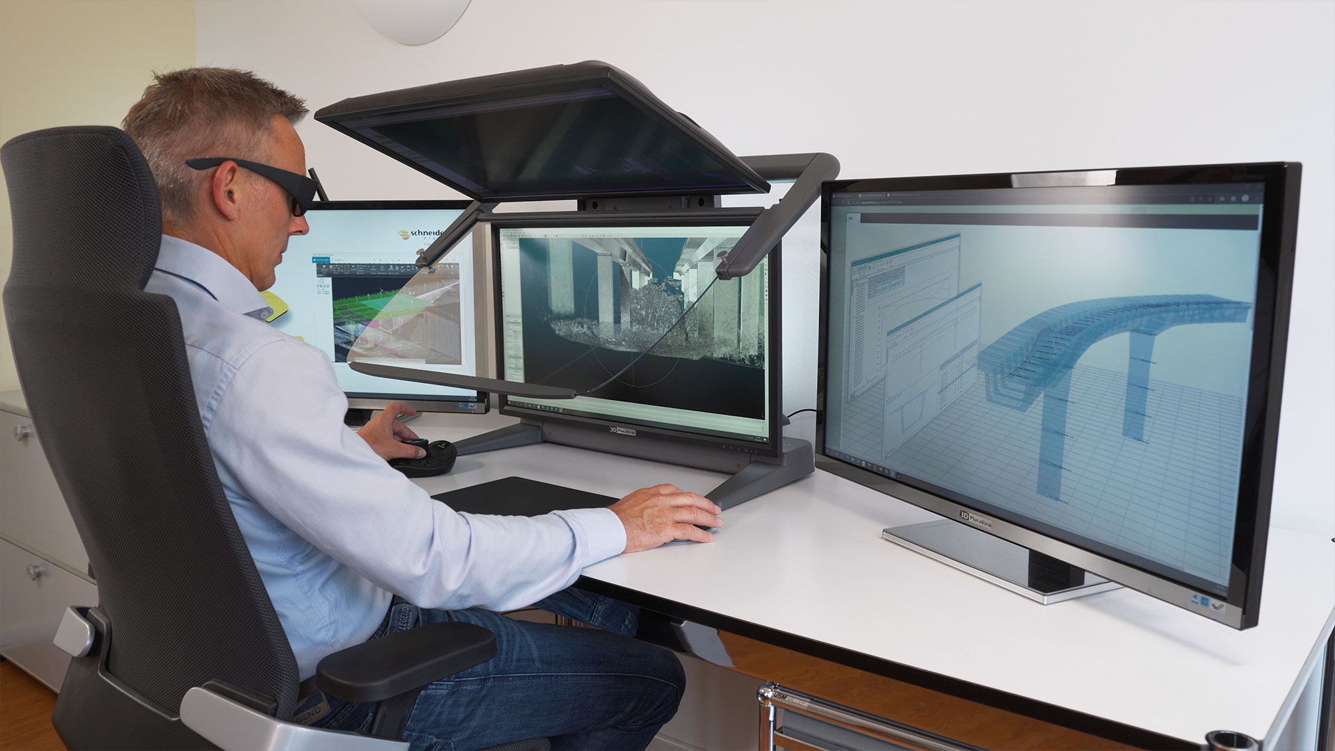
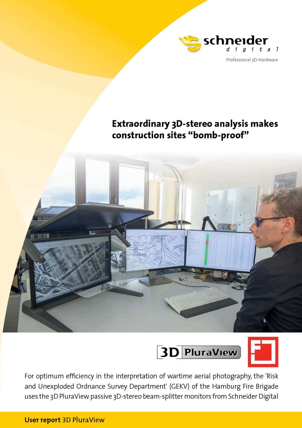
Case Study Feuerwehr Hamburg
Extraordinary 3D stereo work makes construction sites “bomb-proof”
For optimum efficiency in wartime aerial photography interpretation, the ‘risk and unexploded ordnance survey department (GEKV)’ of the Hamburg Fire Brigades uses the 3D PluraView passive 3D stereo beam-splitter monitors from Schneider Digital.
The task:
- Remote sensing and surveillance of construction sites for unexploded ordnance from the Second World War, using historic airphotos and secondary sources
- Achieving the greatest possible level of safety against potential construction site dangers
- Professional analysis using 3D GIS software
- Faster photo interpretation processes, requests dealt with more quickly
The demands placed on 3D visualisation technology:
- Highly detailed, stereoscopic 3D representations of aerial photographs from WWII
- Optimum ergonomics to allow fatigue-free use over the entire working day
- Aerial photography interpretation on the screen in daylight conditions
- Compact form-factor for the desktop, ultra-robust, stable assembly
- Plug & Play system without the need for special software or hardware
- Fully compatible with GIS software applications
- Complete workplace solution with side monitors
Read the entire report:


3D PluraView - Passive 3D stereo monitor for miltary geospatial applications
Professional 3D stereo visualization for GEOINT and immersive, virtual simulation environments
All over the world, armed forces use digital, 3D stereoscopic displays in a variety of application areas, especially for ‘Geospatial Intelligence’ (GEOINT), as well as for immersive, virtual simulation environments. Important GEOINT software applications in the COTS (commercial off-the-shelf) area include Socet GXP from BAE Systems, Collins Sci-X and ArcGIS Pro from ESRI, plus a variety of other GIS, remote sensing and photogrammetry applications from Hexagon, Trimble and Bentley and by other software manufacturers.
As a professional IT solutions provider, Schneider Digital is specialized in the development and manufacturing of stereoscopic display systems, as well as the production of high-performance, professional workstations all of which can be zoned according to NATO SDIP-27 standard. For military use, the Schneider Digital stereoscopic display systems offer the highest resolution, image brightness and maximum ergonomics for fatigue-free work and flexible use with a large number of software applications. Both the passive 3D PluraView monitors does not require any proprietary graphics drivers and can be operated with professional NVIDIA and AMD graphics cards. In combination, the Schneider Digital displays cover all requirements, from the acquisition and analysis of GEOINT data to large-format data presentation in stereoscopic simulation environments.
Complete Geo-IT workspace solutions
Expand your 3D PluraView with powerful workstation hardware!
Schneider Digital is your partner for complete workplace solutions in the field of geospatial applications. Our product portfolio includes all components, from performance workstations specifically tailored to your requirements, 3D input devices (Stealth, Softmouse, 3DConnexion), side monitors up to 8K resolution, as well as professional graphics cards from NVIDIA and AMD.