Esri ArcGIS Pro certified for 3D stereo visualization with 3D PluraView monitors
Process and display 3D geodata in GIS, BIM and LiDAR stereoscopically
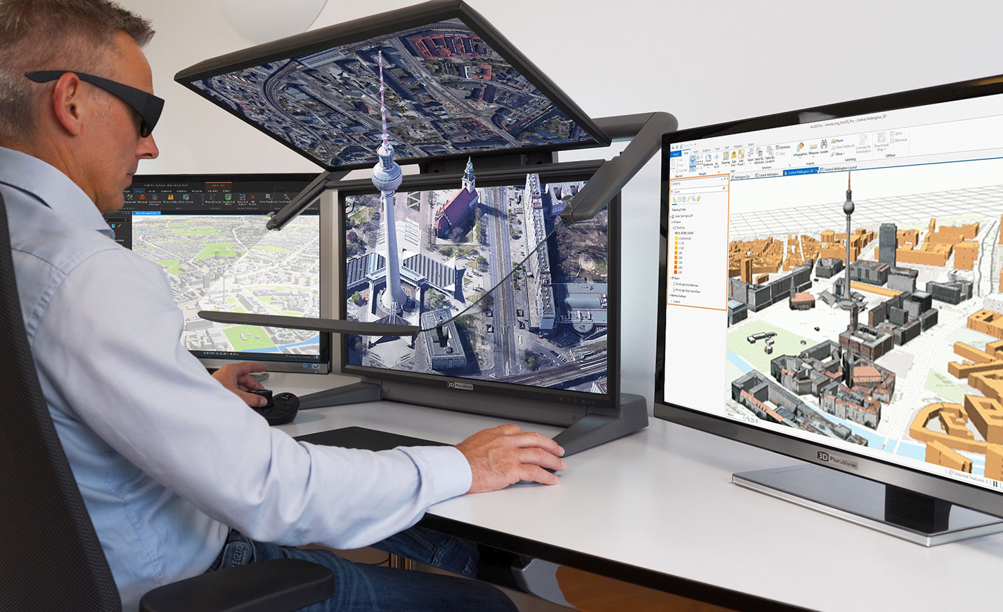
Today, ArcGIS Pro from Esri is the most modern and advanced desktop GIS product and is used worldwide for the capture, processing and analysis of high-resolution 3D data. The constant further development of ArcGIS Pro is increasingly blurring the boundaries between Geographical Information Systems (GIS) and classic digital photogrammetry. Important functionalities from photogrammetry, such as importing aerial images, aero-triangulation, and extraction of terrain models, orthorectification and stereoscopic data capture, are now also integrated in ArcGIS Pro. This ensures a continuous GIS workflow, including photogrammetric data capture, directly in the Esri environment, resulting in substantial efficiency gains. The central element here is the complete integration of all existing and newly captured three-dimensional geometries with ArcGIS Pro, and the integrated ability to represent them with full three-dimensionality on stereoscopic output devices. The Software ArcGIS Pro from Esri meets all requirements for the efficient display and processing of GIS, BIM, LiDAR and photogrammetric geodata in a fully integrated 3D-stereo work environment with an outstanding range of functions. The compatibility of ArcGIS Pro with the entire 3D PluraView monitor product family has now been officially certified by the manufacturer Schneider Digital.
Be it professional thematic maps, complex GIS analyses, geodata management or GIS data capture – with the 3D-capable software application ArcGIS Pro from Esri, professional users enjoy the benefits of the world’s leading GIS environment. For optimal geodata querying and processing, the capture and analysis of spatially connected and topologically correct features, GIS professionals have a whole range of interactive and automated tools at their fingertips with the Pro version. Locally saved geo-information in 2D and 3D format can for example be compared to or synchronized with Cloud servers and online data services. Topographic terrain features and building models at different levels of detail (LOD) can likewise be extracted and saved to file geodatabases (GDB). ArcGIS Pro also offers a range of powerful tools for the management, editing and analysis of large amounts of data, e.g. large-format aerial images, UAS and satellite images, and LiDAR point-cloud data. Real façade textures can be mapped to 3D building geometries from oblique aerial images and vehicle-based mobile camera systems. Likewise, hybrid 3D terrain models can be generated from orthoimages, combined with synthetic 3D models for vegetation and building objects.
Large data volumes – super-high resolution in 3D-stereo on the 3D PluraView monitors
The prerequisite for the stereoscopic display of 3D geodata is a monitor system with high-resolution, bright and contrast-rich 3D stereo visualization, to best support ArcGIS Pro users. This perfect visualization solution is provided by the 3D PluraView family of monitors by Schneider Digital, which are latency-free and work ‘plug-and-play’ with professional NVIDIA and AMD graphics cards.
3D PluraView supported applications:
Contact us: [email protected]